WATCH: Geospatial monitoring and forest crime
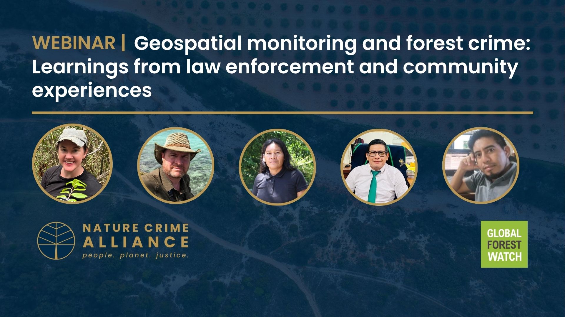
The Nature Crime Alliance brought its members and more than 450 stakeholders together for an information exchange on how geospatial monitoring technologies can counter forest crimes.
Held in partnership with Global Forest Watch, the session showcased perspectives from law enforcement, Indigenous communities, governments, and civil society on the role of these technologies – which use satellite imagery to monitor changes to the Earth’s landscape – in tackling crimes such as illegal logging and illegal mining.
Enforcement efforts in Madagascar
Caitlin Eschmann, Executive Director of Conservation Allies, a member of the Nature Crime Alliance, shared examples from Madagascar, where they work with law enforcement and community partners to identify deforestation in Protected Areas using Global Forest Watch data, and organise interventions. This includes the creation of ‘conservation brigades’ that are having a positive impact in protecting forests in the country. In the Menabe Antimena Protected Area, where conservation brigades operate, deforestation fell by more than 50% between 2023 and 2024, Caitlin said.
Caitlin was joined by Paul Salaman, President of Conservation Allies, for a Q&A session with the audience in which they shared insights from Conservation Allies’ success. The organisation now publishes an annual report on the state of Protected Areas in Madagascar to help policymakers and funders understand the situation on the ground. They are interested in expanding this approach to other geographies. Read the Madagascar Protected Areas Outlook here.
Community and prosecutor experiences in Peru
The focus then turned to Peru, with perspectives from Betty Rubio, Technology Transfer Specialist with the Organisation of Indigenous Peoples of the East (ORPIO), Peru. Betty spoke about the range of information collected by geospatial monitoring that can indicate potential harm to Indigenous territories, which is then passed on to enforcement authorities. This enables immediate action against threats.
Participants also heard from Bratzon Torres Saboya, Adjunct Provincial Prosecutor, Specialized Bureau on Environmental Crimes, Public Prosecutor’s Office of Peru, who discussed how geospatial data is combined with other intelligence, including information gathered in collaboration with the air force, to identify and disrupt criminal actors threatening the Peruvian Amazon.
Innovative uses in Guatemala
The session concluded with insights from Danger Gomez, Head of Geospatial Information Systems, National Forest Institute (INAB) of Guatemala, who discussed how INAB uses deforestation alerts based on geospatial data to identify potential breaches of conservation incentive schemes. Danger discussed the automated system INAB has built to facilitate this monitoring across Guatemala’s forests.
The webinar brought together more than 450 representatives from governments, law enforcement, Indigenous communities, philanthropies, and civil society to learn from our speakers’ experiences. It was moderated by Ruth Nogueron and Luke Foddy and was produced by Isabela Barriga, World Resources Institute.
WATCH THE SESSION IN FULL (ES and FR versions below)
English version
Versión en español
Version française
Keep Informed
Subscribe to Our Newsletter
Sign up here to receive news, analysis and event updates from the Nature Crime Alliance.